Maps are not neutral. Rather than representing reality, they shape it.
Within colonial contexts, they reflect structures of power through the manipulation of geographical space and the production of knowledge.
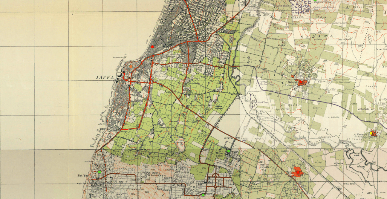
The Zionist movement, and the consequential colonization of Palestine, has always invested in changing the cartography of Palestine to serve its biblical narrative and sovereignty legitimization.
When colonial powers name a territory, they show they have power and control over it.
Since the British Mandate, Palestinians have been excluded from representing their own space, while a biblical narrative was taking over the mapping of Palestine.
Zionist (later Israeli) cartographers, geographers and urbanists started changing many of the names of cities, streets and regions of Palestine.
The “Hebraization” of the geography was an essential component in erasing local history to create a sense of unity for mostly European and American Jewish settlers and to build a new national identity.
The same logic applied to the planting of trees by the Jewish National Fund, to erase space and memory of ethnically cleansed Palestinian villages.
The Hebrew language was designated as the sole means to understand thePalestinian landscape.
Until today, in the most used maps, the Israeli regime has substituted the majority of the Arab names of cities and regions with other ancient or biblical names. A few examples:
Al Quds – Jerusalem
Ariha – Jericho
Al Khalil – Hebron
Naqab – Negev
The erasure of the Arabic place-names has resulted in the fact that many Palestinians do not know of the names of places they live in or go to, before the settler colonial invasion.
This is reinforced by GPS technologies such as Google and Waze, and other Western mapping applications, that hide political and economic interest in their representation of reality.
On Google Maps, Palestine is not mentioned, and one can only see a dotted line along the Green Line (Armistice line of 1949) not reflecting any geographic reality, most often suggesting incorrect route options or leaving places inhabited by Palestinians blank as if it was a No Man’s Land.
In the West Bank, illegal Israeli settlements are signaled and represented very clearly while Palestinian villages are not reflected by Israeli road signs.
Palestinians have started to reclaim their maps as a means of resistance. Counter-mapping is a practice that contributes to the process of re-appropriating the knowledge of Palestine.
From Walid Khalidi’s All That Remains, to Salman Abu Sitta Atlas of Palestine, from Visualizing Palestine and Columbia University’s Studio-X Amman Palestine Open Maps, to Doorob navigator, Palestinians keep fighting to retake ownership on their land.
Useful resources:
- Al Shabaka podcast
- Maps, Technology, and Decolonial Spatial Practices in Palestine
by Zena Agha on Al Shabaka